| SWY0104 |

|
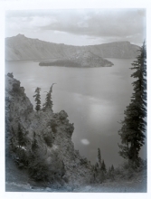
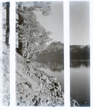
Crater Lake circa 1915 w/ trees from top of Lake Trail near site of Crater Lake Lodge.
|
| SWY0105 |

|
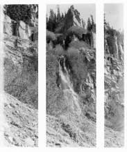
Waterfall from lake level, below Sun Notch.
|
| SWY0106 |
|
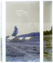
Tents located near Rim Road, just south (or below) the site of Crater Lake Lodge.
|
| SWY0107 |
|
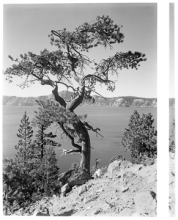
Gnarled Tree, foreground, Crater Lake circa 1915. A ponderosa pine located on the south slope of the north side of Crater Lake.
|
| SWY0108 |
|
Crater Lake circa 1915 from the east side of the rim, likely near Sentinel Point.
|
| SWY0109 |
|
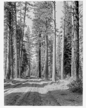
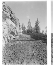
Fort Klamath Road circa 1915 (later called South Entrance Road, Crater Lake Highway or Highway 62 with slightly different alignments).
|
| SWY0110 |
|
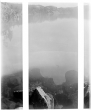
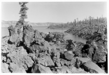
Crater Lake circa 1915 (cracked). Very likely the area of Wineglass, where a beach is located.
|
| SWY0111 |
|
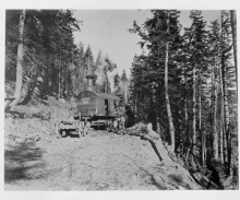
Crater Lake Rim Road circa 1918, wood burning steam shovel used by the Army Corps of Engineers to move rock and stumps.
|
| SWY0112 |
|
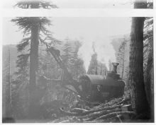
Crater Lake Rim Road circa 1915, wood-burning steam shovel near Anderson Point.
|
| SWY0113 |
|
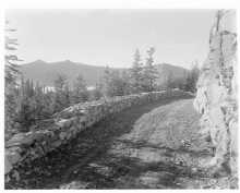
Crater Lake Rim Road circa 1915, dry-laid \"guard wall\" located between Kerr Notch and Anderson Point on the Rim Road.
|
| SWY0114 |
|
Crater Lake Rim Road dry-stack \'guard wall\' located between Anderson Point and Kerr Notch, looking north.
|
| SWY0115 |

|
Engineers Camp in Munson Valley, looking NE toward Garfield Peak, showing blacksmith\'s shop at left, tents, and other buildings of 1914 and 1915.
|
| SWY0116 |
|
Crater Lake circa 1915, remnants of autumn snow at Rim Village, looking east.
|
| SWY0117 |
|
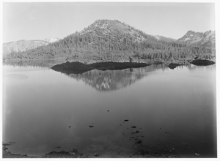
Crater Lake circa 1915, Wizard Island taken from the west rim of the caldera, showing spire and whitebark pine.
|
| SWY0118 |
|
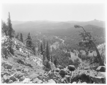
Crater Lake National Park Vista circa 1915. Likely from Garfield Peak looking south with Crater Peak and the upper Klamath Basin in distance.
|
| SWY0119 |

|
Crater Lake National Park vista circa 1915, looking slightly SW toward the Cascade Divide and Union Peak.
|
| SWY0120 |
|
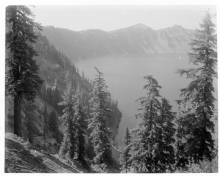
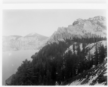
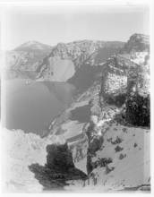
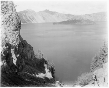
Crater Lake circa 1915, from Garfield Peak looking east, with Phantom Ship, Dutton Ridge, Mount Scott in distance. Also shows the inside of the caldera.
|
| SWY0121 |
|
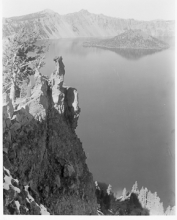
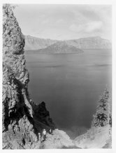
Crater Lake circa 1915, taken from the area of Dyar Rock, with portions of Applegate Peak, Dutton Ridge, Phantom Ship and Mount Scott visible.
|
| SWY0122 |
|
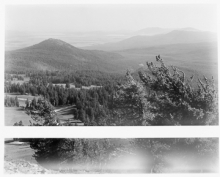
Crater Lake National Park Vista circa 1915, looking S/SW from Garfield Peak with Munson Valley and Cascade peaks in the distance.
|
| SWY0123 |
|
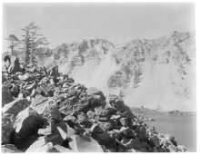
Crater Lake circa 1915 (broken); from west rim with whitebark pine in foreground.
|
| SWY0124 |
|
Crater Lake circa 1915, showing rowboat from Grotto Cove.
|
| SWY0125 |
|
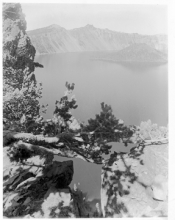
Crater Lake circa 1915, looking SW from the Palisades.
|
| SWY0126 |
|
Crater Lake circa 1915, rowboat at the Palisades.
|
| SWY0127 |

|
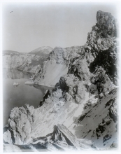
Crater Lake circa 1915, showing Danger Bay with Sentinel Point in the distance.
|
| SWY0128 |
|
Crater Lake circa 1915, looking SE with Palisade Point visible above Cleetwood Cove.
|
| SWY0129 |
|
Crater Lake circa 1915, same as 128 sans boat.
|
| SWY0130 |
|
Crater Lake circa 1915, empty rowboat at Cleetwood Cove with Palisade Point above.
|
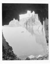
| SWY0131 |
|
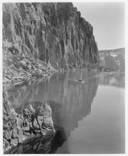
Crater Lake circa 1915, Cliffs, Reflection, Boat (at Cleetwood Cove?)
|
| SWY0132 |
|
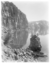
Crater Lake circa 1915, boat at Palisade Point with portions of Wineglass and the Palisades visible.
|
| SWY0135 |
|
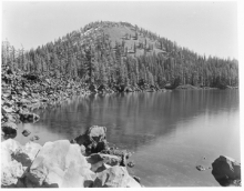
Crater Lake circa 1915, Wizard Island. Taken from the west rim, beyond Rim Village.
|
| SWY0136 |
|
Crater Lake waterfall, likely in Pinnacles Valley on the face of Dutton Cliff.
|
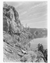
| SWY0137 |
|
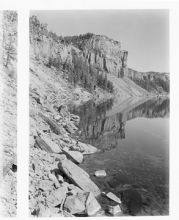
Crater Lake circa 1915, crags and reflections. Taken from the eastern shore looking toward Dutton Ridge.
|
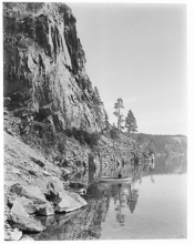
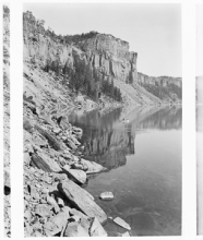
| SWY0138 |
|
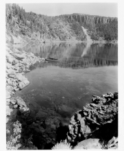
Crater Lake circa 1915; virtually the same view as 137, taken from the lake\'s surface.
|
| SWY0139 |
|
Crater Lake circa 1915, Phantom Ship. Looking north near Dutton Ridge from Chaski Bay.
|
| SWY0140 |
|
Crater Lake circa 1915, Phantom Ship. Same view as 139 except for man in the boat.
|
| SWY0141 |

|
Crater Lake circa 1915. Possibly Skell Head instead of Sentinel Rock.
|
| SWY0142 |
|
Crater Lake circa 1915, probably from the Lake Trail that ran through Eagle Cove to the water.
|
| SWY0143 |
|
Crater Lake circa 1915. Hikers on the Lake Trail in Eagle Cove.
|
| SWY0144 |
|
Crater Lake circa 1915, looking toward Hillman Peak in the distance from the eastern shore.
|
| SWY0145 |

|
Crater Lake rockslide in the crater of the cinder cone called Wizard Island.
|
| SWY0146 |

|
Crater Lake circa 1915, Boat
|
| SWY0147 |
|
Crater Lake circa 1915. Northwestern portion of Wizard Island beyond Fumerole Bay and close to the Emerald Pool.
|
| SWY0148 |
|
Crater Lake circa 1915. Looking toward the Watchman Slide from Wizard Island, showing a portion of Skell Channel.
|
| SWY0149 |
|
Crater Lake circa 1915, showing a portion of the Watchman, Skell Channel, and taken from Fumerole Bay.
|
| SWY0150 |
|
Crater Lake circa 1915, from a boat looking SE toward the cinder cone of Wizard Island.
|
| SWY0151 |

|
Wizard Island circa 1915, with the Emerald Pool in foreground, cinder cone in the distance.
|
| SWY0152 |
|
Crater Lake circa 1915 and Wizard Island. Shows the western extent of the island, which is situated on a \"platform.\" This view shows a portion of Skell Channel looking east from the shore.
|
| SWY0153 |
|
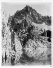
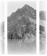
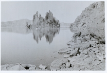
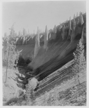
Crater Lake area, probably the Wheeler Creek Pinnacles via the park\'s east entrance, circa 1915.
|
| SWY0154 |
|
Crater Lake area, near the park\'s east entrance. Most likely the Wheeler Creek pinnacles circa 1915.
|
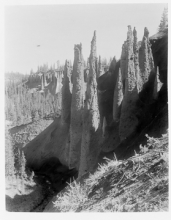
| SWY0155 |
|
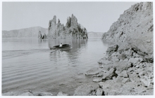
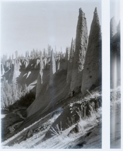
Near Crater Lake National Park\'s east entrance, the Wheeler Creek pinnacles, circa 1915.
|