| SWY0001 |
|
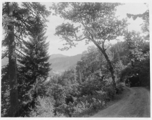
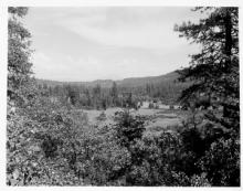
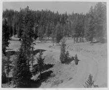
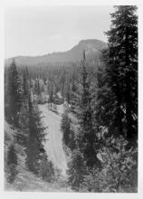
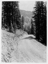
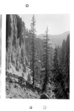
Probably Crater lake Highway between Eagle Point and the west boundary of Crater Lake National Park. |
| SWY0002 |
|
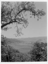
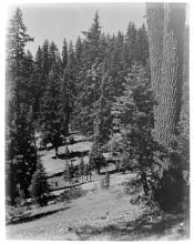
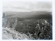
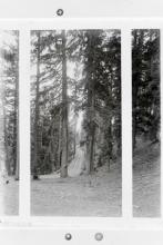
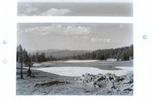
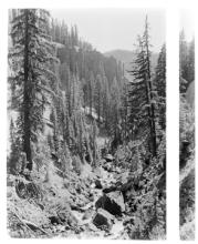
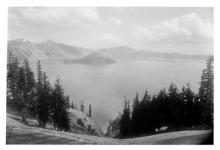
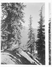
Wide vista circa 1915, Mt McLoughlin in background, with trees in foreground (same vista as SWY0003).
|
| SWY0003 |
|
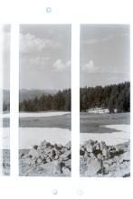
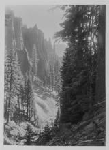
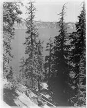
Wide vista circa 1915, Mt McLoughlin, Jackson County, Oregon
|
| SWY0004 |
|
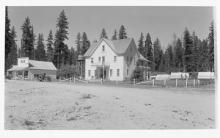
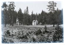
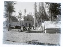
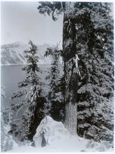
Prospect Hotel circa 1915, Jackson County, Oregon</span>
|
| SWY0005 |
|
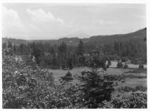
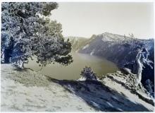
Wide vista, farmlands, looking back toward Medford and the Rogue Valley on the road to Crater Lake (west boundary).
|
| SWY0006 |
|
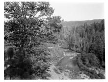
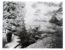
Rogue River circa 1915
|
| SWY0007 |
|
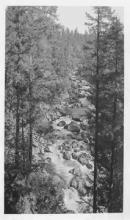
Rogue River near Prospect circa 1915
|
| SWY0008 |
|
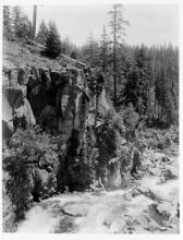
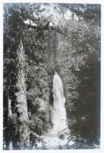
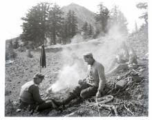
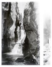
Mill Creek Falls circa 1915, Jackson County, Oregon
|
| SWY10 |
|
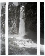
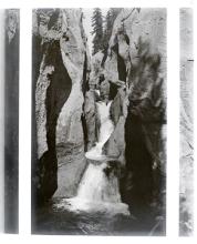
Mill Creek Falls circa 1915, Jackson County, Oregon
|
| SWY11 |
|
Mill Creek Falls circa 1915, Jackson County, Oregon
|
| SWY0012 |
|
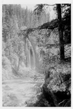
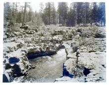
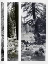
Natural Bridge on Rogue River circa 1915, rock rubble, forest
|
| SWY13 |
|
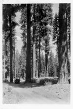
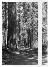
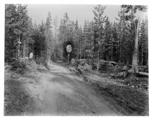
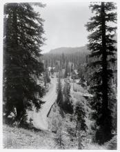
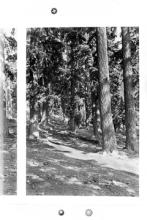
Crater Lake Highway circa 1915, model T, thick trees, driver. Shows approximate width of the Fort Klamath - Rogue River Wagon Road, likely from the south and east side.
|
| SWY14 |
|
Crater Lake Highway (Fort Klamath-Rogue River Wagon Road), circa 1915, big trees
|
| SWY15 |
|
Wide view Rogue River circa 1915 and thick forest
|
| SWY16 |
|
Wide view Rogue River circa 1915 and thick forest
|
| SWY17 |
|
Crater Lake Highway circa 1915, wooden Notice sign. West Entrance of Crater Lake National Park, on the Fort Klamath-Rogue River Wagon Road, prior to relocation by the Army Corps of Engineers.
|
| SWY0018 |
|
Crater Lake National Park Supervisor\'s office circa 1915, old cars, Park Headquarters (at Annie Spring).
|
| SWY0019 |
|
Mtn road to cabins, thick. Looking south toward Crater Lake National Park Headquarters at Annie Spring, ca 1915. Graded width indicates work by the Army Corps of Engineers (16 feet shoulder to shoulder).
|
| SWY0020 |
|
Thick forest, covered wagon, wide. Looking east with view of road segment near Crater Lake National Park Headquarters at Annie Spring.
|
| SWY21 |
|
Mtn road to cabins, thick. Road segment width indicates construction by Army Corps of Engineers in the Annie Spring
|
| SWY0022 |
|
Mtn road to cabins, above Annie Spring with Camp Arant; Arant Point in distance, Crater Lake National Park
|
| SWY0023 |
|
Cabins, tents, old cars, portion of Camp Arant at Annie Spring, Crater Lake National Park Headquarters at that time.
|
| SWY0024 |
|
Small Lake, waterfall
|
| SWY0025 |
|
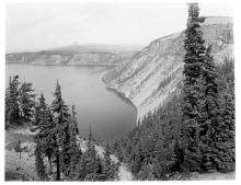
Wide vista, trees and ridges. Looking west from the Rim Road, Crater Lake National Park.
|
| SWY0026 |
|
Mountain climbers sitting in field (foreground) just off the Crater Lake Rim Road, with Mount Scott in the background.
|
| SWY0027 |
|
Mtn road through big trees; view looking south toward Annie Spring and Crater Lake National Park Headquarters.
|
| SWY0028 |
|
Probably road to Crater Lake, circa 1915. Location is on the Fort Klamath Road, south of the Engineer\'s Camp (now Park Headquarters), showing portion of Castle Crest leading to Garfield Peak.
|
| SWY0029 |
|
Probably road to Crater Lake, circa 1915. Likely location is south of the Engineer\'s Camp on the Fort Klamath Road, surrounded by mountain hemlock and Shasta red fir.
|
| SWY0030 |
|
Scenery near Crater Lake, circa 1915. Looking west toward Union Peak from segment of the Rim Road just south of Rim Village.
|
| SWY0031 |
|
Scenery near Crater Lake, circa 1915. Portion of the same view as SWY0030, view to southwest of Rim Village on a segment of the Rim Road.
|
| SWY0032 |
|
Dewie/Duwee/Dewey Falls, Crater Lake National Park circa 1915
|
| SWY0033 |
|
Dewie/Duwee/Dewey Falls, Crater Lake National Park circa 1915
|
| SWY0034 |
|
Munson Creek circa 1915, Godfrey Glen (Garden of the Gods) Spires, Crater Lake National Park, looking north.
|
| SWY0035 |
|
Munson Creek circa 1915, Godfrey Glen (Garden of the Gods) spires (pinnacles), Crater Lake National Park
|
| SWY0036 |
|
Munson Creek circa 1915, Godfrey Glen (Garden of the Gods) spires (pinnacles) looking north, Crater Lake National Park
|
| SWY0037 |

|
Munson Creek above Dewie Falls, Godfrey Glen (Garden of the Gods) spires, looking north, Crater Lake National Park
|
| SWY0038 |
|
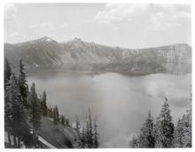
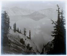
Crater Lake circa 1915, Wizard Island, wide angle. Location is east of Crater Lake Lodge above the Lake Trail, Rim Village.
|
| SWY0039 |
|
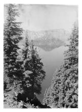
Crater Lake circa 1915, Wizard Island from east of Crater Lake Lodge, large tree near top of the Lake Trail, looking northwest.
|
| SWY40 |
|
Crater Lake circa 1915, Wizard Island from Rim Village. Location is near top of Lake Trail, east of Crater Lake Lodge
|
| SWY0041 |
|
Crater Lake circa 1915 through trees, island reflection. Location is on the Rim Road, not far from Discovery Point.
|
| SWY42 |
|
Crater Lake circa 1915. Location is the Sentinel Rock Trail from the Rim Road with Cloudcap to the right, Mt. Thielsen in the distance.
|
| SWY0043 |
|
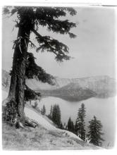
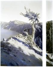
Crater Lake vista circa 1915, closeup tree, Lake and cliffs. Location has to be above most of the Lake Trail from Rim Village, looking north/northeast.
|
| SWY0044 |
|
Crater Lake vista circa 1915, closeup tree, lake and cliffs. From the Lake Trail below Rim Village. Portion of Llao Rock in the distance.
|
| SWY0045 |
|
Crater Lake circa 1915, tree, rock. Looking northwest with Watchman and Hillman in the distance. Taken from a segment of the Lake Trail below Rim Village.
|
| SWY0046 |
|
Gnarled tree at Crater Lake circa 1915, from Garfield Peak with Roundtop and Grotto Cove in the distance.
|
| SWY0047 |
|
Gnarled tree at Crater Lake circa 1915. View from Garfield Peak with Grotto Cove and Roundtop in the distance.
|
| SWY0048 |
|
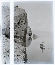
Man fishing in Crater Lake circa 1915. View taken from a location near the Phantom Ship, looking northwest past Wizard Island.
|
| SWY0049 |
|
Crater Lake circa 1915, man in boat. Photo taken near Phantom Ship. looking northwest. Watchman and Hillman Peak in the distance.
|
| SWY0051 |
|
Crater Lake circa 1915, Wizard Island. Photo taken from the Eagle Crags area east of Crater Lake Lodge at Rim Village.
|
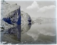
| SWY0052 |
|
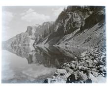
Crater Lake circa 1915--Sentinel Rock Shoreline, reflection. View from southeast part of Crater Lake near Phantom Ship, with top of Cloudcap on right side.
|